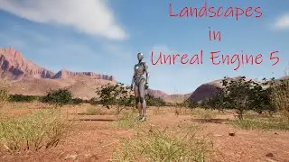
Landscapes in Unreal Engine 5 -Archived - NASA Satellite Imagery and World Machine for Height Maps
Because of changes to Microdem and the way we need to used World Machine because of the changes, this video has been archived. The new video can be found at: • Landscapes in Unreal Engine 5 - Video...
In this video I will show you how to use free DEM imagery downloaded from NASA to create height maps. We will crop them down to a usable size, and pixels for 1 meter resolution, and smooth them using Microdem, a free software from Microdem.org. We will use the exported GEO TIFF we created and import it into World Machine. We will add some erosion and then export the height map as a .png for Unreal. We will add some slope exporters and export them as height maps to use for our textures in Unreal Engine. We will also be using World Partition in UE 5.1 to manage our landscape during game play. There will be a lot going on here and I will do my best to explain everything as I go along in the video. Also, I had an error in Unreal Engine 5.1 at the end with the minimap we created. It was an issue with that project, and I created a new project and will show you what it should look like towards the end of the video.
Updates to the video because of software changes:
1) With the new Microdem download you will get a popup telling you that GDal is not installed. If you wish to get rid of the GDal popup, go to this site to install OSGeo4W. https://trac.osgeo.org/osgeo4w. Under the Quick Start for OSGeo4W Users section there is a link to the installer. Download the installer and follow the instruction for an Express install. As you install OSGeo4W, there will be a choice for which server to download from, I usually choose the top one. After that there will be an option to download 4 or 5 packages. You only need the GDal one for this. Once installed open up Microdem and point it towards OSGeo4W.
2) The Reinterpolate step and two smoothing steps after seems to break the process now and will not give you the data you need in your Geotiff for it to work correctly in World Machine. After you crop your map to the 4km area, stop and export that as a Geotiff using the process I show you in the video that is after the Mean and Median smoothing steps. This skips the reinterpolate and the smoothing. But it will allow you to move forward and create your world for Unreal. Before you leave Microdem, go back to the Info tab and select Map. Get the z range. It should be a lower number to a higher number. For example, in my Aspen map this is my z range: 2130 to 2662 m.
3) Once you import your Geotiff into World Machine, you will need to go down to the Elevation section of the File Input window and change it from Natural file elevations to Specify range. Then use the Map z range from Microdem to fine tune your map for the correct elevation range.
I will keep working on why the data seems to be getting lost after the reinterpolate step. Once I have this all figured out, I think there have been enough changes I will need to make a new video.
Links you will need:
World Machine - https://www.world-machine.com/
Updated Link - Microdem.org - https://microdem.org/
ASF NASA Imagery - https://search.asf.alaska.edu/#/?zoom...
NOAA Latitude/Longitude Distance Calculator - https://www.nhc.noaa.gov/gccalc.shtml
UE 5.1 Landscape Technical Guide - https://docs.unrealengine.com/5.1/en-...
Thanks to Tomasz Kuczyński for some of the methods shown in this video - / @tomaszkuczynski70
00:00:00 – 00:05:39 Introduction and project demonstration
00:05:40 - 00:12:11 Discussion of the software we will be using and where to get it
00:12:12 – 00:20:41 Getting DEM satellite imagery from ASF
00:20:42 – 00:38:50 Modifying the imagery size in Microdem
00:38:50 – 00:45:53 Interpolating, smoothing, and saving as GEO TIFF in Microdem
00:45:54 – 01:02:30 Creating our Height Maps in World Machine
01:02:31 – 01:17:23 Importing the Height Map into UE 5.1 and setting up the landscape
01:17:24 – 01:18:28 Outro