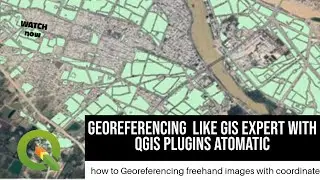
Arc GIS tutorial: how to topology professional on Maping
#shear_subscrip
#learning_arcGIS
#Link
/ @geography_map1
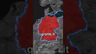
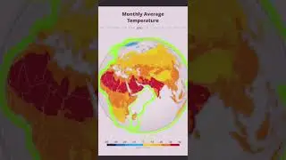
Topography refers to the detailed written representation of a place or area including lakes, major rivers, mountains, valleys, latitudes, and roads. The term is also used to refer to the comprehensive study of the surface of the earth, moon, asteroids, meteors, and other planets. The word “topography” is derived from two Greek words namely “topos” and “graphein.” These words mean “place” and “to write” respectively. Topography is interconnected with surveying. Some of the earliest detailed surveys were championed by the US’s Topographical Bureau of the Army in 1812. Nonetheless, in the 20th-century topographical mapping began to take its course as a more accurate measure of places. The focus of topography today is a three-dimensional representation of the surface of the earth. Scientists achieve this objective by measuring and recording the contour lines. Most recently, the use of satellite technology has resulted in Google Maps which happens to be the first complete and widely available survey of planet earth.
![Готовое интро для Sony Vegas Pro[Bizzar Template]](https://images.videosashka.com/watch/h8u-KLp1YSc)