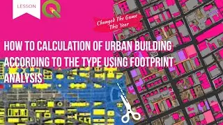
Footprint Analysis: Type-Based Urban Building Calculation
What is a building footprint?
Building footprints are polygons representing the extent of individual building structures in the physical world. They are often accompanied by contextual metadata about what the building is, how it relates to nearby places, and what its address is.
Polygon data in GIS
Geospatial data is typically compiled and stored as one of two main formats: vector or raster. Vector data can be divided further into three types: points, lines, and polygons. All three of these data types can vary in size depending on the geographic extent they represent, and can be applied in a wide variety of use cases. For example, polygons can range anywhere from entire continents to specific units within an office complex depending on the needs of the end user. The general rule of thumb is: if the feature is a collection of lines connected by vertices, resulting in a closed shape on Earth’s surface, it’s a polygon.
Building polygon data
While there are endless entities in the world that can be represented by a polygon, building footprints are commonly used for mapping and analytics workflows that involve specific places. This level of granularity is necessary when understanding how buildings relate to each other, the physical environment, and the accessibility of infrastructure like roads and sidewalks.
Building footprint data is most valuable when it forms a solid foundation for contextualizing and analyzing a location. A singular building polygon that denotes where on Earth a structure exists can be mapped, but if it is inaccurate or out-of-date, the derived context, analytics, or visualizations are not useful. In fact, it could lead to misinformed decision-making and misallocation of resources.
How are building footprints created?
There are multiple ways to acquire building footprint data, ranging from creating it yourself, scraping open source databases, and purchasing it from a provider. Each provider has their own methodology for digitizing and curating data for their end users. In this section, we’ll go over the basics and then explain Ecopia’s market-leading methodology.
How to create building polygons
As we mentioned earlier, geospatial data can be formatted as either vector or raster. While the final output of creating building footprint data is ultimately vector data (polygons), raster data is needed to extract and digitize real-world features.
Raster data essentially divides the Earth’s surface into a grid and stores geographic information within each grid cell (also commonly referred to as pixels). This is how satellite and aerial imagery data is prepared and stored. There are many ways raster data can be used as-is, but many GIS users ultimately digitize features from imagery data so that they can use them as vector polygons.
Building polygons for insurance risk assessment
When pricing a policy for property insurance, underwriters must calculate the risk of a specific property and structure. Oftentimes, this is done by measuring a building’s proximity to a flood zone, or identifying whether or not a property is adjacent to a high-risk business (such as an industrial plant containing flammable chemicals). But regardless of what underwriters are measuring the risk of, what does not change is the importance of correctly locating the property’s exact extent so as not to under- or over-price a policy.
This need for precision is what makes building footprints an integral part of insurance underwriting. While singular latitude and longitude point coordinates can represent the approximate location of a property, they do not provide the level of detail needed to understand how the building itself relates to nearby risks.
#arcgis #geography #maping #maps #qgis
.........................................................
GEM-TECH Geography
ArcGIS pro tutorial for beginners,
ArcGIS tutorial,
ArcGIS pro,
qgis tutorial making a map,
qgis making a map,
qgis class
gis, Geographic Information Systems
ArcGIS pro,
remote sensing
#mapping #gis #maps #cartography #geography #qgis #arcgis #sig #geoprocessamento #جی_آی_اس
-For more information and communication with the admin, you can use the following communication method:
Telegram: GEM-TECH Geography
@QAM_12345
Email: GEM-TECH Geography
[email protected]
Facebook: GEM-TECH Geography
https://www.facebook.com/profile.php?id=10...
Mega Millions drawing


![[MIRRORED] K-POP RANDOM DANCE || Old & New (2014-2024)](https://images.videosashka.com/watch/KZspeS6SH-I)


