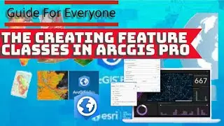
Arcgis pro tutorial: how to Creating Feature Classes in ArcGIS Pro
ArcGIS Pro is a full-featured professional desktop GIS application from Esri. With ArcGIS Pro, you can explore, visualize, and analyze data; create 2D maps and 3D scenes; and share your work to ArcGIS Online or your ArcGIS Enterprise portal. The sections below introduce the sign-in process, the start page, ArcGIS Pro projects, and the user interface.
ArcGIS Pro is desktop GIS software developed by Esri, which replaces their ArcMap software generation. The product was announced as part of Esri's ArcGIS 10.3 release, ArcGIS Pro is notable in having a 64 bit architecture, combined 2-D, 3-D support, ArcGIS Online integration and Python 3 support.
A major version update occurred with the release of ArcGIS Pro 3.0 in June, 2022. Several major changes include: the dropping of support for geocoders created with ArcMap 10.x and versions of ArcGIS Pro 2.9.x and earlier; project files created or modified with ArcGIS Pro 3.0 are not readable by versions 2.9.x and earlier; geodatabases created in 3.0 may not be fully compatible with prior versions; and perhaps most significantly, Parcel Fabric datasets created in prior versions must be upgraded to be fully compatible in version 3.0.
There are four primary ways to create a feature class:
Using the Create Feature Class wizard
Using the Create Feature Class geoprocessing tool
Saving the contents of a feature layer
Converting an external data source, such as a shapefile or CAD data, into a feature class
When creating a feature class, you choose whether to create one that stores polygons, lines, points, annotation, multipoint, multipatch, or dimension features. See Define feature class properties for information about the various properties that must be set during the creation of a feature class.
..........................................................
GEM-TECH Geography
arcgis pro tutorial for beginners,
arcgis tutorial,
arcgis pro,
qgis tutorial making a map,
qgis making a map,
qgis class
gis, Geographic Information Systems
arcgis pro,
remote sensing
#mapping #gis #maps #cartography #geography #qgis #arcgis #sig #geoprocessamento #کیوجی_آی_اس #جی_آی_اس #کارتوگرافی #maping
-For more information and communication with the admin, you can use the following communication method:
Telegram: GEM-TECH Geography
@QAM_12345
Email: GEM-TECH Geography
[email protected]
Facebook: GEM-TECH Geography
https://www.facebook.com/profile.php?id=10...


![Star Citizen - Making Money with an Aurora [GIVEAWAY]](https://images.videosashka.com/watch/o7JyUhfZ3Wo)