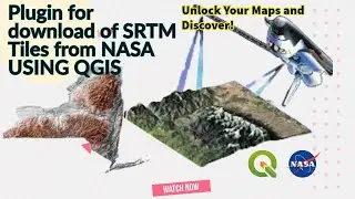
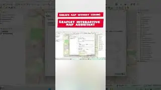
QGIS tutorial: how to Unlock Your Maps and Discover Free NASA SRTM DEM tiles in QGIS
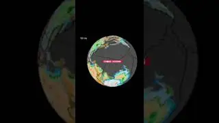
Space Shuttle Radar Topography Mission
During its 11-day mission, the Space Shuttle Endeavour, carrying SRTM, orbited the Earth 16 times.
As part of this mission, it captured Earth’s topography at 1 arc-second (30 meters) for over 80% of the Earth’s surface.
Using synthetic aperture radar and interferometry, SRTM has collected one of the most accurate digital elevation models of Earth.
Now, this data is freely available on the USGS Earth Explorer.
SRTM DEM 30m and 90m resolution
Before September 2014, the best available SRTM Digital Elevation Model (DEM) was a 90-meter resolution.
srtm shuttle radar topography mission
Now, the 30-meter (1 arc-second) resolution SRTM is publicly available on the USGS Earth Explorer for most of the globe. This enhanced version presents the full resolution of the original measurements.
The global digital elevation model has a spatial resolution of about 30 meters covering most of the world with an absolute vertical height accuracy of less than 16 meters.
Where can you download the SRTM data?
In late 2014, the United States announced that it would release its highest possible resolution SRTM data to the public. Your best place to download SRTM tiles is through the USGS Earth Explorer.
.........................................................
#mapping #gis #maps #cartography #geography #qgis #arcgis #sig #geoprocessamento #کیوجی_آی_اس #جی_آی_اس #کارتوگرافی #maping
-For more information and communication with the admin, you can use the following communication method:
Telegram:
@QAM_12345
Email:
[email protected]
Facebook:
https://www.facebook.com/profile.php?id=10...