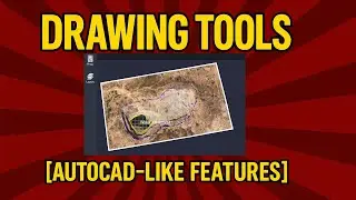
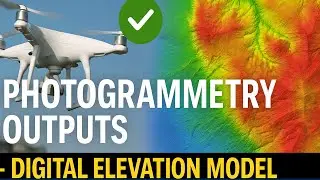
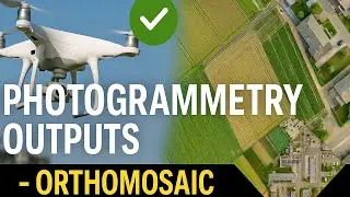
Photogrammetry Outputs — Orthomosaic
Photogrammetry is a technique used to measure and map physical objects or environments using photographs. In this series we will embark on a captivating journey through the realm of photogrammetry and its outputs.
If you prefer reading, please follow the blog:
/ photogrammetry-outputs-orthomosaic
Find more similar blogs on our medium channel,
/ surveygyaan
Find more similar videos on our playlists here
Surveyaan Geoworkspace: • Suveyaan GeoWorkspace
Drone Survey and AutoCAD: • Drone Survey and AutoCAD
Register on https://app.surveyaan.com/ to use our Photogrammetry Software named Surveyaan GeoWorkspace.
Social Media
Facebook: / surveyaan
Twitter: / surveyaan
LinkedIn: / surveyaan
Website: https://www.surveyaan.com/
Youtube: / @surveygyaanbysurveyaan
And also feel free to subscribe to our channel SurveyGyaan by Surveyaan provided below for more videos.
/ @surveygyaanbysurveyaan


![IELTS Listening Practice Test 2024 with Answers [Real Exam - 420 ]](https://images.videosashka.com/watch/mS1rYfQ5Yq0)