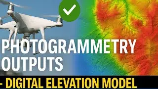
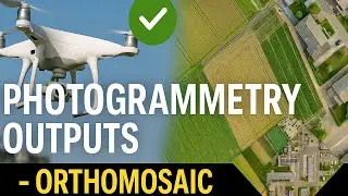
Photogrammetry Outputs - Digital Elevation Model
Digital Elevation Models (DEMs) have become vital tools for a range of applications in the fast evolving field of remote sensing and geospatial technology, with drone surveying at the forefront.
If you prefer reading, please follow the blog:
/ photogrammetry-outputs-digital-elevation-m...
Find more similar blogs on our medium channel,
/ surveygyaan
Find more similar videos on our playlists here
Surveyaan Geoworkspace: • Suveyaan GeoWorkspace
Drone Survey and AutoCAD: • Drone Survey and AutoCAD
Register on https://app.surveyaan.com/ to use our Photogrammetry Software named Surveyaan GeoWorkspace.
Social Media
Facebook: / surveyaan
Twitter: / surveyaan
LinkedIn: / surveyaan
Website: https://www.surveyaan.com/
Youtube: / @surveygyaanbysurveyaan
And also feel free to subscribe to our channel SurveyGyaan by Surveyaan provided below for more videos.
/ @surveygyaanbysurveyaan