Digitization In QGIS || QGIS For Absolute Beginners #6 || QGIS Tutorials For Beginner || GeoFox
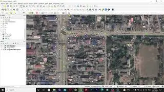
This is the absolute beginners guide for QGIS. In this video, we will learn how to digitize using google satellite imagery in QGIS.
You can download the course materials from:
https://drive.google.com/drive/folder...
------------------------------******-----------------------------
Other videos of this series:
1) Course Content:
• QGIS For Absolute Beginners #1 || Cou...
2) Basic Of QGIS:
• QGIS For Absolute Beginners #2 || Bas...
3) Plugin In QGIS:
• QGIS For Absolute Beginners #3 || Plu...
4) Working with vector data:
• QGIS For Absolute Beginners #4 || Wor...
5) Working with Raster Data:
• Working With Raster Data || QGIS For ...
------------------------------******-----------------------------
#QGIS #QGIS_tutorial #QGIS_For_Beginners #QGIS_For_Free #QGIS_Basic #QGIS_Software #Geographic_Information_System #GeoFox #GIS #GIS_Tutorial #ArcGIS #Vector_Data #Raster_Data #Clip #Georeferencing #Digitization #Plugin #Digitization_In_QGIS
Keywords:
Digitization in QGIS, How to digitize in QGIS, QGIS For Beginners, QGIS Tutorials, QGIS Basic, QGIS Tutorial, QGIS For free, Beginners guide, qgis, arcgis,free, how to, absolute, beginners guide, qgis 3, pi, digitizing, map making, 3d, visualization, geospatial, data, geographical information systems, data science, introduction to qgis, complete beginners guide to qgis, qgis for beginners youtube,qgis tutorial for beginners in hindi, qgis for beginners pdf, qgis tutorial for beginners in nepali, qgis tutorial for beginners in English, introduction guide to qgis for beginners, qgis basics, qgis beginner tutorial, qgis tutorials for beginners,qgis for mapping, qgis beginners guide, digitization in qgis, qgis tutorial, qgis making a map, open source, qgis tutorial making a map, clip in qgis, union in qgis, dissolve in qgis, georeferencing in qgis, digitization in qgis, plugin in qgis, quick osm,