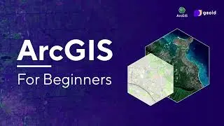
Complete Beginner's Guide to ArcGIS: GIS Tutorial with Practical Examples
Welcome to our comprehensive beginner's tutorial on ArcGIS! In this video, we'll walk you through the fundamentals of Geographic Information Systems (GIS) and provide hands-on guidance for using ArcGIS software. Whether you're new to GIS or looking to refresh your skills, this tutorial will equip you with essential knowledge.
👉Training Datasets:
https://drive.google.com/drive/folder...
----------------------- My Other Videos --------------------------------
Do watch my other videos:
Leaflet Full Course:
• Leaflet Full Course || Leaflet Crash ...
Top 10 GIS Software Applications In 2022
• Top 10 GIS Software Applications In 2...
How To Create A Contour Using DEM Data
• How To Create A Contour Using DEM Dat...
How To Create A Covid-19 Map Using QGIS
• How To Create A Covid-19 Map Using QG...
Supervised Classification Using ArcGIS:
• Supervised Classification Using ArcGI...
How To Create A Map With OSM Data Using QGIS:
• How To Create A Map With OSM Data Usi...
How to Create A Choropleth Map Using Leaflet:
• How To Create A Choropleth Map Using ...
Create A Map Layer Using Leaflet:
• Leaflet JS Tutorial || Create A Map L...
Add A Marker To The Map Layer:
• Leaflet JS Tutorial || Add A Marker T...
Use Different Map Tile Layer In Leaflet:
• Leaflet JS Tutorial || Use Different ...
Add Google Map To Your Website:
• Leaflet JS Tutorial || Add Google Map...
Layer Group And Control In Leaflet:
• Leaflet JS Tutorial || Layer Group An...
Add Shapefile in leaflet:
• Leaflet JS Tutorial || Add Shapefile ...
How to add GeoJSON File in leaflet:
• Leaflet JS Tutorial || Use GeoJSON Wi...
👉Here is the timeline:
0:00:00 – Introduction to GIS
0:03:23 – Course Contents
0:07:44 – ArcGIS User Interface
0:11:44 – Adding Vector Data to the ArcGIS
0:15:34 – Working with attribute data in the attribute table
0:17:07 – Style (Symbology) and labeling of vector data.
0:20:14 – Folder Connection in ArcGIS
0:20:48 – Clip In ArcGIS
0:24:33 – Intersect In ArcGIS
0:26:30 – Dissolve In ArcGIS
0:28:54 – Buffer In ArcGIS
0:31:59 – Creating vector data in Google Earth Pro and adding in ArcGIS
0:38:23 – Selection by Attribute
0:39:45 – Exporting into ESRI Shapefile format.
0:41:47 – Selection by Location
0:43:13 – Calculating the geometry (Area and Length)
0:44:55 – Digitization in ArcGIS on the basis of a drone image.
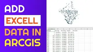
0:52:39 – Adding tabular data in ArcGIS (CSV file format)
0:53:54 – Display X-Y coordinates
0:54:27 – Style (Symbology) and labeling of tabular data.
0:57:16 – Adding Raster Data to the ArcGIS
0:58:35 – Extract by mask (same as a clip-in vector)
01:01:48 – Style (Symbology) and labeling of raster data
01:03:20 – Slope In ArcGIS
01:05:55 – Aspect In ArcGIS
01:07:45 – Hillshade In ArcGIS
01:09:37 – DEM and Contour formation from survey data (Total Station data)
01:15:25 – Map Layout in ArcGIS.
Make sure to watch the entire video to gain a solid understanding of ArcGIS. If you find this tutorial helpful, please like, share, and subscribe for more GIS tutorials.
Don't forget to explore the timestamps to navigate directly to the topics you're interested in.
#GIS #ArcGIS #Tutorial #BeginnersGuide #Geospatial #Mapping #DataAnalysis #DataVisualization #GISTraining #SpatialAnalysis #Topography
#ArcGIS #ArcGIS_Tutorial #GIS #Geographic_Information_System #GIS_Tutorial #ArcMap #GIS_Beginners #gis_software
Keywords:
The GIS Hub, gis tutorial, gis tutorials, arcgis tutorial, basic gis tutorial, gis tutorial for beginners,gis mapping, arcgis full course, ArcGIS for beginners, arcgis tutorial full, arcgis desktop tutorial,arcgis map tutorial, what is gis,gis complete tutorial, tutorial arcgis, ArcGIS basic tools for beginners, advanced arcgis tutorial, gis and remote sensing, gis, arcgis tutorial for beginners, gis for beginners, introduction to arcgis for beginner, ArcGIS for beginner