In this tutorial you will be able to manage your attribution table well. That is add new fields, edit or delete existing once. The tutorial is interesting especially for beginners in this software!
Scan all file free
ВЕНГА ЭТО ЛУЧШИЙ ГЕРОЙ В ДОТЕ // СТРЕЙ ИГРАЕТ НА МИДОВОЙ ВЕНГЕ
Проблемы ETF Финекс, БПИФ Сбера и ВТБ на фоне санкций против России / Инвестиции в акции
Miss scum Slayer reborn||Episode 117||Completed||ZIN MANGA
СЛАБОНЕРВНЫМ НЕ СМОТРЕТЬ!!! СТРАШНАЯ АВАРИЯ НА ШОССЕ!!! МЕРТВЫЕ ЛЮДИ В СМЯТОЙ МАШИНЕ!!!
Free Fire Auto Headshot Config File🎯🌠 Macro Aimbot + No Recoil Regedit ‼️ Antiban VIP Script 👽
Shadow Priest Arena | BIG DAMAGE THIS SEASON | WoW Shadowlands Season 1 2v2 3v3
Активные Детишки от ТЗ Компливит - вкусные витамины для детей с 3-х лет в форме жевательных пастилок
Paramétrage des unités de la station totale RUIDE série RQS
HOW TO IMPORT SURVEY DATA IN CIVIL 3D | Part 2 of 2
HOW TO IMPORT SURVEY DATA IN TO CIVIL 3D | Part 1 of 2
Comment calculer le Vo dans Covadis ?
How to Carry Out a 3D Survey in Global Mapper?
How to Limit Drainage Basins (Watersheds) Automatically in Global Mapper?
How to Use the Digitizer (Edit) Tool in Global Mapper? | Part 2
How to Use the Digitizer (Edit) Tool in Global Mapper? | Part 1
How to Digitalize in Global Mapper?
How to Export Data (SHP, CSV, DWG & Others) In Global Mapper?
How to Georeference a raster image/map in Global Mapper?
How to Import Data from Excel to Global Mapper?
How to convert DXF to SHP in ArcGIS?
How to Label in ArcGIS?
How to apply Symbology in ArcGIS?
GEOMETRY CALCULATION-HOW TO CALCULATE THE PERIMETER AND SURFACE AREA OF YOUR WORKING ZONE IN ARCGIS?
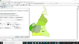
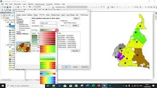
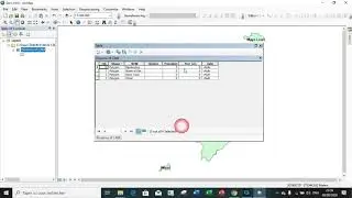
How to create, edit and delete fields in an attribution table in ArcGIS Software?
Comment creer une couche Shapefile à partir d'un fichier AutoCAD DXF dans QGIS?
Comment évaluer la superficie de chevauchement de deux parcelles de terrain | Intersection
Comment determiner la superficie et le périmètre d'une zone dans QGIS ? |
Comment ajouter, éditer et supprimer un champs dans une table d'attributs dans QGIS ?
How to Generate list of Figures or Tables in WORD Software
Comment extraire les données d'une zone pour un projet d'aménagement dans QGIS ?
Comment faire une mise en page dans QGIS | Comment Produire une carte dans QGIS ?