AutoCAD Civil 3D Tutorial Road Profile Creation From File in AutoCAD Civil 3D, ACAD, AutoDesk C3D
Civil 3d How TO CREATE A PROFILE IN CIVIL 3D FROM EXTERNAL FILE WITH CHAINAGE AND ELEVATION DATA
To Create a Profile From a Profile File | AutoCAD Civil 3D | Autodesk
About Creating Layout Profiles | AutoCAD Civil 3D | Autodesk
About Importing Text From External Files | AutoCAD | Autodesk
About External Data References | AutoCAD Civil 3D | Autodesk
Autodesk AutoCAD Civil 3D Profile: Station & Elevation Profile
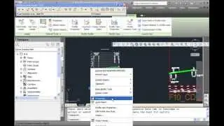
Click Home tab
Create Design panel
Profile drop-down
Create Profile From File Find.
Browse to the text file (a text file uses the .txt extension).
Click the text file and click Open.
If the file is correctly formatted, it is read into the system and the Create Profile - Draw New dialog box is displayed.
In the Create Profile - Draw New dialog box, review and revise any settings you want to change for the profile name, description, and styles.
Click OK to save the profile in the drawing.
Use profile files to record layout data for points of vertical intersection (PVIs) in a profile.
Format Requirements of Profile Files:
A profile file is a simple text file in ASCII format. The file contains a series of stations along an alignment, the elevation of each station, and optionally, the length of curve at the station. Each line can include up to three information elements, separated by spaces:
Station. An element required for each line. Plus characters (+) cannot be used.
Elevation. A required element.
Curve length. An optional element. However it cannot be used on the first or last line of the file. All vertical curves must be parabolic.
In this example, only the third and fifth PVIs include curves (lengths of 40.0 and 35.0). Use these other format requirements for each profile file
The first and last lines must not contain curve information.
The first line must provide the station and elevation for the first station. Stations must be in ascending order.
No leading blank lines or headers.
No blank lines; a blank line is read as the end of the file.
No blank spaces at the beginning of any line.
The last item must be the elevation for the last station.
autocad what is it
Civil 3D Profile Creation
Please visit my other videos also
List of Tutorials in Playlist:
AutoCAD- How to Draw Grid Lines With Text in AutoCAD Coordinates Grid - AutoCAD Online Tutorial
• AutoCAD- How to Draw Grid Lines With ...
Autocad Rotate UCS in Model Space - Rotate View in AutoCAD Drawing - AutoCAD Online Tutorial
• Autocad How To Rotate Viewport in Mod...
AutoCAD Civil 3D Points Creation from AutoCAD Points - Convert AutoCAD Points Civil 3D Tutorial
• How to Use AutoCAD Civil 3D Points Cr...
How To Convert Autocad to PDF - DWG to PDF - PDF TO DWG PDF To Autocad Free and Online Training
• How To Convert Autocad to PDF - DWG t...
How to Export AutoCAD Coordinates for Polyline and Points to MS Excel
• How to Export AutoCAD Coordinates for...
Autocad Best Commands And Techniques Best Autocad Tricks Part 1
• Autocad Best Commands And Techniques ...
Autocad Best Commands And Techniques Best Autocad Tricks - Part 2
• Autocad Tricks Best Commands And Tech...
AutoCAD- How to Make A Custom Linetype in AutoCAD
• AutoCAD- How to Make A Custom Linetyp...
Earthwork Crossection Of Formation Level Of A Road In AutoCad
• Earthwork Crossection Of Formation Le...
Autodesk Civil 3D Road Profile and Drawing Settings - Simple Road Profile
• Autodesk Civil 3D Road Profile and Dr...
Manual Earthwork Cross Sections and Calculations by Average End Area Method in AutoCAD
• How to Draw Manual Earthwork Cross Se...
Microstation Trick for Printing by Using Print Organizer, Batch Print.
• Microstation Trick for Printing by Us...
AutoCAD - How To Add Custom Paper Size To A Printer
• AutoCAD- How to Make A Custom Linetyp...
AutoCAD- How to Make A Custom Linetype in AutoCAD
• AutoCAD- How to Make A Custom Linetyp...
Layout in AutoCad 2007
• How To Scale Autocad Layout Template ...
Visit my profile and buy my gigs with love
https://www.fiverr.com/jamiltayyab
LICENSE TERMS
AutoCAD is a registered trademark of Autodesk, Inc., in the USA and other countries. The thumbnail used shows the software presented for educational purposes.No Copyright Infringement Intended Credits: AutoDesk.
Tags,
autocad,road Profile,Profile from file,autocad civil 3d,civil 3d,acad,autocad 3d,autocad what is it,3d,civil,tutorial,autodesk,jamil tayyab,profile in civil 3d,profile,how to create profile in civil 3d,how to create a profile in civil 3d,road profile in civil 3d,how to split a profile in civil 3d,Civil 3D Profile Creation,profile craetion,civil 3d profile,draw your own profile civil 3d


![[FREE FOR PROFIT] Три дня дождя x МУККА type beat | Pop punk type beat -](https://images.videosashka.com/watch/xdqqIm7zulU)