Importing a Google Earth / Bing Map into Civil3D Integrate Google Earth Aerial Map With Civil 3D
Importing a Google Earth / Bing Image into Civil3D Integrate Google Earth Aerial Map With Civil 3D
In this video tutorial, you learn how to import google earth maps into AutoCAD Civil 3d.
First of all, you have to assign the geolocation to your drawing from the drawing settings.
then by using Aerial map you can easily insert google earth image into your drawing.
Read full article here
https://freecadtipsandtricks.com/inde...
♣ My Website: http://freecadtipsandtricks.com/
♥ Subscribe Here: / jamiltayyab786
♠ FaceBook: / freecadtipsandtricks
My Gadgets:
Desktop - i7
https://amzn.to/3240zNR
Monitor - 21.5 Inch
https://amzn.to/2L3NCMY
Mouse
https://amzn.to/2NssCCp
Laptop
https://amzn.to/2KPXATe
Headphones
https://amzn.to/31Y3NCn
Microphone
https://amzn.to/2MBhSBY
Watch I am using
UAE Store: https://amzn.to/2MAsbGr
Mobile Phone
UAE Store: https://amzn.to/2NtABzi
#google #earth to#cad
#googleearthtocad
#cadearth
#georeferenciacion
#autocadmap
#googlemapstodwg
#civil3dgoogleearth
#howto #googleearthcivil3d #googleearthcivil3d2019 #curvasdenivelgoogleearthcivil3d #googleearthtocad #googleearth #civil3d #autocadcivil3d
cad earth
Google maps to dwg
civil 3d google earth
#AutoCAD #AutoDesk #Civil3D #Tutorial #JTCAD
Please visit my other videos also
List of Tutorials in Playlist:
AutoCAD Dynamic Block for Door With Rotation, Scale, Mirror, Stretch Free Online Tutorial Classes
• How to Make Dynamic Block in AutoCAD,...
How to Draw a Line in Feet & Inches or Meter & mm By Using the Autocad Basic LINE Command - Tutorial
• How to Draw a Line in Feet & Inches o...
How to Create & Insert a Block in AutoCAD - All About AutoCAD Blocks
• How to Create Block in AutoCAD - All ...
How to Export Civil 3D Drawing to AutoCAD DWG Easily Convert Drawings Classes
• How to Export Civil 3D Drawing to Aut...
AutoCAD How to Use Insert Field Command to Create Easting, Northing XYZ Coordinates - Free Classes
• AutoCAD How to Use Insert Field Comma...
Free Lisp for Calculation of Slope,Gradient of Line - X and Y intercepts How To Use With AutoCAD
• Free AutoCAD Lisp Routines to Calcula...
AutoCAD- How to Draw Grid Lines With Text in AutoCAD Coordinates Grid - AutoCAD Online Tutorial
• AutoCAD- How to Draw Grid Lines With ...
AutoCAD Command Alias Editor, Keyboard Commands & Shortcuts Guide, Tutorial Create a Command Alias
Very Useful to improve speed and productivity
• How to Use AutoCAD Command Alias Edit...
Autocad Rotate UCS in Model Space - Rotate View in AutoCAD Drawing
https://bit.ly/2qNNSX0
AutoCAD Civil 3D Points Creation from AutoCAD Points - Convert AutoCAD Points Civil 3D Tutorial
• How to Use AutoCAD Civil 3D Points Cr...
AutoCAD Civil 3D Tutorial Road Profile Creation From File in AutoCAD Civil 3D, ACAD, AutoDesk C3D
• AutoCAD Civil 3D Tutorial Road Profil...
How To Convert Autocad to PDF - DWG to PDF - PDF TO DWG PDF To Autocad Free and Online Training
• How To Convert Autocad to PDF - DWG t...
AutoCAD Civil 3D - Grid Points on Surface - Grid Points Coordinates
• AutoCAD Civil 3D - Grid Points on Sur...
AutoCAD Civil 3D Tutorial, Survey Traverse Adjustment in Civil 3D
• AutoCAD Civil 3D Tutorial, Survey Tra...
AutoCAD Tutorial - How To Print Layout on Custom Paper Size in AutoCAD- Online Course
• AutoCAD Tutorial - How To Print Layou...
Autodesk Civil 3D Road Profile and Drawing Settings - Simple Road Profile
• Autodesk Civil 3D Road Profile and Dr...
How to Draw Manual Earthwork Cross Sections and Calculations by Average End Area Method in AutoCAD
• How to Draw Manual Earthwork Cross Se...
Surface Profile from Google Earth - Google Earth Topography Profiles - Google Earth for surface
• Surface Profile from Google Earth - G...
How to Create A Printable List of Files and Folders in A Directory - Windows Helping Trick r list
• How to Create A Printable List of Fil...
Average Cut Fill Volume of Road
• Average Cut Fill Volume of Road
AutoCAD Printing to JPG, JPEG or PNG High Res Picture - Autocad DWG Convert to jpg
• Convert AutoCAD DWG to JPG high resol...
Microstation Trick for Printing by Using Print Organizer, Batch Print.
• Microstation Trick for Printing by Us...
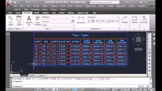
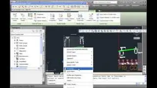
Autodesk AutoCAD Civil 3D - Create Pipes and Road Crossing Ducts Civil 3D - Part 1&2
• Autodesk AutoCAD Civil 3D - Create Pi...
• Autodesk AutoCAD Civil 3D - Create Pi...
Civil 3D Tutorial - Road Profile Creation in Civil 3D by AutoCAD elements.
• Civil 3D Tutorial - Road Profile Crea...
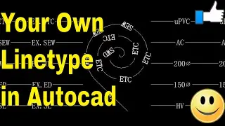
AutoCAD- How to Make A Custom Linetype in AutoCAD
• AutoCAD- How to Make A Custom Linetyp...
• AutoCAD- How to Make A Custom Linetyp...
Autocad Civil 3D Tutorial - Create Pipes and Road Crossing Ducts Civil 3d
• Autocad Civil 3D Tutorial - Create Pi...
How To Scale Autocad Layout Template & Title Block, Layout Setting
• How To Scale Autocad Layout Template ...
LICENSE TERMS
AutoCAD is a registered trademark of Autodesk, Inc., in the USA and other countries. The thumbnail used shows the software presented for educational
purposes.No Copyright Infringement Intended Credits: AutoDesk.
Default Tags:
autocad commands, autocad shortcuts, xref autocad, basic autocad commands, reference drawing, autocad basic commands, cad commands, advanced autocad
training, jt cad, learning autocad course free,


![[ Live ] Roblox : Funky Friday เล่นเพลงรออัพเดทใหม่ [ โดเนท 5 บาทขึ้นจอ ]](https://images.videosashka.com/watch/ERsbbvtcRzw)