River Network And Catchment Area In 3D Demo || 3D-GIS || GeoFox
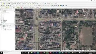
Hello Everyone, This is a demo video for creating a River network and catchment area using qgis and representing that in 3d format.
#QGIS
#3D_GIS
#GIS
#GeoFox
#WebGIS
------------------------- My Other Videos --------------------------------
Do watch my other videos:
How to download OSM data from QGIS:
• How To Download And Use OSM Data Dire...
How To Create A Covid-19 Map Using QGIS
• How To Create A Covid-19 Map Using QG...
Supervised Classification Using ArcGIS:
• Supervised Classification Using ArcGI...
How To Create A Map With OSM Data Using QGIS:
• How To Create A Map With OSM Data Usi...
How to Create A Choropleth Map Using Leaflet:
• How To Create A Choropleth Map Using ...
Create A Map Layer Using Leaflet:
• Leaflet JS Tutorial || Create A Map L...
Add A Marker To The Map Layer:
• Leaflet JS Tutorial || Add A Marker T...
Use Different Map Tile Layer In Leaflet:
• Leaflet JS Tutorial || Use Different ...
Add Google Map To Your Website:
• Leaflet JS Tutorial || Add Google Map...
Layer Group And Control In Leaflet:
• Leaflet JS Tutorial || Layer Group An...
Add Shapefile in leaflet:
• Leaflet JS Tutorial || Add Shapefile ...
How to add GeoJSON File in leaflet:
• Leaflet JS Tutorial || Use GeoJSON Wi...
-------------------------------------------------------------
Keywords:
River Network, Catchment area, watershed delliniation, gis, qgis, 3d gis, 3d in qgis, qgis 3d, how to map 3d, how to make 3d map, 3d map in qgis,


