Generating elevation profile in Google earth and QGIS | GeoDev
Elevation profile is helpful for:
Visualizing terrain: Elevation profiles provide a clear visual representation of the changes in elevation along a route, helping users understand the terrain and identify steep climbs, descents, plateaus, and other changes in elevation.
Route planning: Elevation profiles assist in planning routes effectively, allowing users to select routes that match their fitness level or preferences, and helping them avoid overly challenging or monotonous terrain.
Estimating effort and time: Elevation profiles aid in estimating the effort required to complete a route and the time it may take, helping users set realistic expectations and plan breaks or rest periods accordingly.
Safety and navigation: Elevation profiles can be used for safety purposes, helping users identify potential hazards such as cliffs, steep drops, or avalanche-prone areas. They also aid in navigation by providing reference points and landmarks along the route, enhancing wayfinding in remote areas.
Training and fitness tracking: Elevation profiles are useful for training purposes, allowing outdoor enthusiasts to track their progress, monitor their fitness level, and set goals based on the difficulty of routes.
Trip documentation: Elevation profiles serve as documentation or records of completed routes, providing useful information for creating trip reports, sharing trip details, or remembering past adventures.
Download google earth pro: https://earth.google.com/intl/earth/d...
DEM download: • Download High Resolution DEM data Fre...
Timestamps:
0:00 Intro
0:22 Important of elevation profile
1:40 Elevation profile in google earth
5:08 Elevation profile in QGIS with DEM
----------------------------------------------------------------------------------------
Here are some playlists that you might be interested in:
----------------------------------------------------------------------------------------
1. Leaflet from basic to advance: • Leaflet from basic to advance
2. GeoServer with leaflet web-GIS: • GeoServer and Leaflet Web-GIS
3. GeoDjango project: • Bookmark note on map | GeoDjango tuto...
4. geoserver-rest: • geoserver-rest
5. GIS training in Nepali: • Beginner GIS training in Nepali | Arc...
6. LULC map production: • LandUse Land Cover Map production || ...
7. Geospatial analysis with python: • GeoSpatial analysis with python
8. GeoNode from basic to advance: • GeoNode from basic to Advance
9. Machine learning from the basic: • Machine Learning for geospatial data
--------------------------------------------------------------------------------------------------------------
Check out my discounted courses at the following link:
--------------------------------------------------------------------------------------------------------------
1. "Geospatial data analysis with python": https://www.udemy.com/course/geospati...
2. "Web GIS Development 2021": https://www.udemy.com/course/web-gis-...
3. "Web mapping and Web-GIS from Dev to Deploy 2021: GeoDjango": https://www.udemy.com/course/web-mapp...
4. "Introduction to Web Mapping and Web GIS 2020: GeoDjango": https://www.udemy.com/course/introduc...
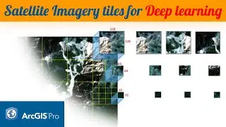
5. Deep Learning Application for Earth Observation: https://www.udemy.com/course/deep-lea...
6. Geospatial Data Analysis with Python: https://www.udemy.com/course/geospati...
---------------------------------------------------------------------------------------------------
Follow me on GitHub: https://github.com/iamtekson
Follow me on Twitter: / iamtekson
Follow me on Instagram: / iamtekson
Join Facebook group: / 1049524025731229
-----------------------------------------------------------------------------------------------------