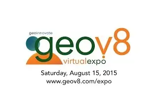
Geov8 Expo 2015 Promo Video
Geov8 2015 Virtual Expo Schedule
To learn more, visit »»http://geov8.com
Geov8 2015 Virtual Expo Welcome & Introduction
Time: 10am-10:15am
Host: Eric Colburn, Colburn Strategic Partners
Summary: Welcome, introductions and overview of Geov8 2015 Virtual Expo.
Topic Tags: Geov8
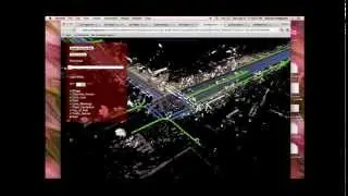
Innovative Surveying & Mapping Geospatial Technology Integrations
Time: 10:15am-11:00am
Presenter: Eric Colburn, Colburn Strategic Partners
Summary: The latest technological advances in close-range photogrammetry technologies.
Topic Tags: Photogrammetry, Land Surveying, Workflow Optimization
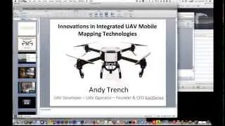
Innovations in Integrated UAV Mobile Mapping Technologies
Time: 11:00am-12:00pm
Presenter: Andy Trench, XactSense
Summary: Overview of turnkey UAV aircraft, geospatial scanning, and sensor integration including innovative GPS-free UAV surveying platform gained XactSense national recognition as robotics and disruptive technology innovators in a rapidly growing market
Topic Tags: Drones, UAV, Photogrammetry, Laser Scanning, Flight Automation
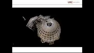
Will Photogrammetry Make Laser Scanning Obsolete?
Time: 12:00pm-1:00pm
Presenter: David Boardman, Stockpile Reports
Summary: This presentation will illustrate how reality indexing and photogrammetry is solving major business challenges on and offsite. David Boardman’s discussion and demonstration will cover current 3D computer generation, customer-use cases for profit and non-profit, future applications, large-scale measurements, and how photogrammetry is currently contributing to inventory measurement solutions in the construction, mining and aggregates industry.
Topic Tags: Photogrammetry, Laser Scanning, 3D Computer Generation
Think Global, Act Hyperlocal: Why Proximity is King
Time: 1:00pm-2:00pm
Presenter: Sameer Babbar, Zapiator
Summary: This presentation will illustrate how big-data and analytics is solving business challenges that were previously too hard, or too expensive to solve. The presentation will cover how users analyze and make local decisions by gathering local information and integrating their own data with ease using the Zapiator platform.
Topic Tags: GIS, Geography, Big Data, Location Analysis
A Scalable Approach to Point Cloud Processing
Time: 2:00pm-3:00pm
Presenter: Sravan Puttagunta, Civil Maps
Summary: Civil Maps is a search engine for point cloud data. It has the capability to scan the digital representation of the physical world and index objects of interest. In addition, it has the capacity to study the relationships between assets as well. Utilizing deep learning it is now possible to create self assembling asset descriptors that are useful to process terabytes of point cloud data. During this talk we will go over the deep learning process and educate potential beta users on how to contribute to a self learning platform.
Topic Tags: Laser Scanning, 3D Machine Control, CAD/Design/BIM
Presentation TBD
Time: 3:00pm-4:00pm
Presenter: Daniel Martin, NOAA/NOS/National Geodetic Survey
Summary: TBD
Topic Tags: TBD
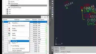
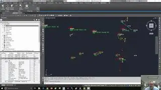
AutoCAD Civil3D Surveyor Survival Strategies
Time: 4:00pm-5:00pm
Presenter: Eric Colburn, Colburn Strategic Partners
Summary: This presentation describes the planning process, shows basic setup procedures, highlights critical settings so you know your work is correct and success strategies working with AutoCAD Civil 3D. In addition to the mechanics of AutoCAD Civil 3D, like Styles, Labels Styles, Survey Databases and Description Key Sets, Eric Colburn’s presentation covers advanced uses including GIS, Point Clouds, visualizations and marketing.
Topic Tags: AutoCAD Civil 3D, Land Surveying, Workflow Optimization