Developing geospatial webapps with Python and Django - Tutorial
There are many ways to display spatial data, from the traditional maps, GIS desktop software and most recently on the web. We face certain challenges to display spatial data on the web because we will require certain functionalities that we find on a desktop software and certain spatial analysis tools implemented as buttons. Django is a web framework written in Python that allows to create web applications with moderate simplicity and this framework is capable of displaying vector spatial data using libraries such as Folium.
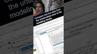
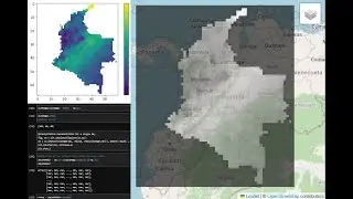
We have created a tutorial with an applied case of displaying hydrological spatial information on a webapp in Django. The tutorial creates a Django project, creates an app for the spatial data representation, imports the vector data (geojson or shp) and displays spatial data with defined styles.
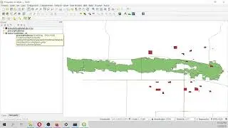
Input data
You can download the input data from this link:
https://www.hatarilabs.com/ih-en/deve...
![[NRA 2019] NEW Beretta 92X Performance Pistol](https://images.videosashka.com/watch/SpWSjue_8G4)