Tutorial 3 - 3Dsurvey | Image Import with EXIF/GPS based orientation
CLICK HERE TO DOWNLOAD 3Dsurvey FREE TRIAL!
http://bit.ly/3DsurveyFreeTrial
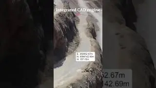
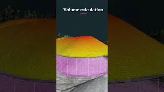
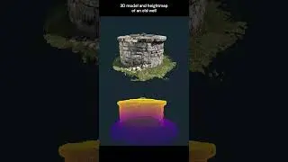
This tutorial shows how to start your project and demonstrates the workflow from importing images and EXIF data to generating a point cloud and calculating an orthophoto.
This scenario applies if you're using images captured by drones, such as Inspire 1, eBee, Falcon 8, or any other UAV that records GPS data (cca. 1.5m accuracy) and saves it as part of EXIF inside your image file (typically .jpeg).
Subscribe to 3Dsurvey: http://bit.ly/3DsurveyYTsubscribe
---- Follow 3Dsurvey ----
Subscribe to 3Dsurvey: http://bit.ly/3DsurveyYTsubscribe
On our website: http://www.3Dsurvey.com
On Facebook: / modriplanet
On Twitter: / 3dsurveydrone