3Dsurvey Scan module promo
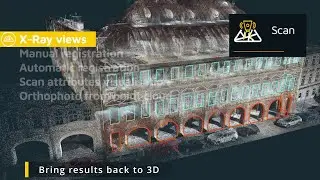
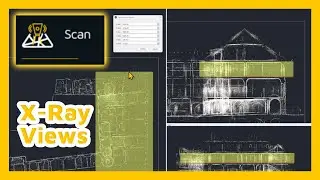
0:14 X-ray views
1:58 Manual point cloud registration
2:27 Automatic point cloud registration
3:08 Scan attibutes visualisation
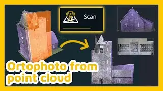
3:28 Orthophoto from point cloud
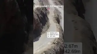
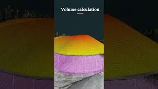
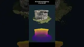
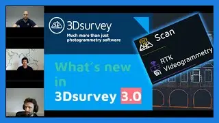
Discover the Scan module, designed to integrate point clouds or meshes from various sources such as photogrammetry, videogrammetry, LIDAR, sonar, SLAM, GNSS, and total stations. Perfect for combining data from different locations using identical points, this module allows you to visualize your drone LIDAR data, SLAM, or terrestrial scanner data with options like intensity, number of returns, and scanning time. An ideal add-on for users looking to produce accurate floor plans from their scan or SLAM data.
Check out special promotion, get the new modules 50% off!
https://3dsurvey.si/3dsurvey-3-0-laun...
3Dsurvey: SAVE TIME AND GAIN CONTROL. 💪
Hit the SUBSCRIBE button to stay updated ☑️
Start the FREE TRIAL now: https://bit.ly/3D-free-trial
Follow us on social media:
Facebook: / 3dsurveysoftware
Instagram: / 3dsurvey
Linkedin: / 3dsurvey
Or visit our website: https://3dsurvey.si/


![[2] Umugani w'Ibimanuka byategetse u Rwanda. Ukuri kurimo ni ukuhe? Ibisobanuro bya F. Rudakemwa](https://images.videosashka.com/watch/H38VPFSRC9g)