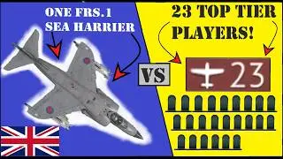
Entire Lobby Slaughtered By One (Critically Damaged) FRS.1 Sea Harrier - :)
This week, I took the FRS.1 out for a stroll.
.
.
.
.
.
.
Photo Credits:
Vulcan bomber:
By Alastair Barbour - commons.wikimedia, CC BY 2.5, https://commons.wikimedia.org/w/index...
Victor tanker:
By RuthAS - Own work, CC BY 3.0, https://commons.wikimedia.org/w/index...
Sea Harrier:
By Andrew P Clarke (D2180s at English Wikipedia - commons file, CC BY-SA 4.0, https://commons.wikimedia.org/w/index...
HMS Conqueror:
By Courtesy of Navyphotos: Image on website, Fair use, https://en.wikipedia.org/w/index.php?...
CC BY-SA 2.0, https://commons.wikimedia.org/w/index...
Galtieri
By Casa Rosada (Argentina Presidency of the Nation), CC BY-SA 2.0, https://commons.wikimedia.org/w/index...
Falklands map:
By Eric Gaba (Sting - fr:Sting) - Own work ;Topographic map : NASA Shuttle Radar Topography Mission (SRTM3 v.2) (public domain) edited with dlgv32 Pro/Global Mapper and vectorized with Inkscape ; UTM projection ; WGS84 datum ; shaded relief (composite image of N-W, W and N lightning positions) ;Approximate scale of topographic data and shore / lakes limits : 1:705,000 ; of the bathymetry : 1:3.720.000Bathymetry : USGov public domain data provided by the Demis add-on for World Wind (see the approval e-mail) ;Other references used for additional data :* UK government map ;* NASA World Wind ;* CIA map available on the site of the University of Texas at Austin ;* Microsoft Encarta atlas (1999 edition).Note : The shaded relief is a raster image embedded in the SVG file which increases its size. If you want a lighter map for other purposes, delete the shaded relief image in your file., CC BY-SA 3.0, https://commons.wikimedia.org/w/index...
General Belgrano:
By Unknown author - http://www.histarmar.com.ar/InfHistor..., Public Domain, https://commons.wikimedia.org/w/index...