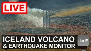
🔴 Live Now: 24/7 Iceland Volcano Watch (Multi-cams)
на канале: afarTV
IMO REPORT April 22: Uplift continues beneath Svartsengi but the rate has decreased
Uplift in Svartsengi continues, but the rate has significantly decreased and is now similar to the period before the eruption that began on April 1. As magma accumulation continues beneath Svartsengi, repeated magma intrusions and even eruptions in the Sundhnúkur crater row must be considered.
The Icelandic Meteorological Office continues to monitor the development of magma accumulation and assess possible scenarios based on the latest data.
Micro-earthquake activity continues near the magma intrusion that formed on April 1, with an average of about one hundred earthquakes per day in the past week. Most of the earthquakes are below magnitude 1, with the largest one recorded at magnitude 1.7 during the past week. There was also some minor earthquake activity near Fagradalsfjall last weekend. Calm weather in recent days has allowed the monitoring network to detect even the smallest earthquakes that would otherwise likely not be recorded due to weather noise.
Minor seismic activity is still being recorded around the dike intrusion that formed on April 1, with dozens of earthquakes occurring daily in the area. The largest earthquake over the past week was a magnitude 3.3 on April 13, located over the northern part of the dike intrusion, about 4 km ENE of Keilir. Most of the earthquakes are under magnitude 2 and at depths of 2 to 6 km.
Uplift at Svartsengi continues, though the rate has slowed compared to last week. The current rate is about twice as fast as it was just before the last eruption, and is similar to the rate observed at the start of the current eruption cycle that began in 2024.
The Icelandic Meteorological Office continues to monitor the area, track magma accumulation, and assess possible scenarios based on the latest data. As long as magma continues to accumulate beneath Svartsengi, repeated magma intrusions and even eruptions along the Sundhnúkur crater row must be considered possible.
---
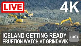
This camera is situated on the southern tip of Þorbjörn. Þorbjörn is a 243 m high volcanic mountain next to the town of Grindavík.
For our 4K full-screen livestreams from Iceland, visit the AfarTV channel LIVE page: / @afartv
----
How you can help:
Help the people displaced at Grindavík (Red Cross): https://www.raudikrossinn.is/english
Give to the Iceland Search and Rescue: https://www.landsbjorg.is/icelandic-a...
If you are in Iceland, dine at the only restaurant in Grindavik that remains open: Papa's Pizza https://papas.is/ . The food is great and the owners are such nice people who have helped AfarTV without asking for anything in return!
Thanks!
----
You can help monitor earthquakes!
Dive into the fascinating world of seismology and join a global network of hobbyists using Raspberry Shake’s powerful earthquake sensors. Get 10% off your own monitor by visiting this link:
https://shop.raspberryshake.org/?ref=...
----
Sources
Iceland Met Office - data, cameras, news
Iceland Civil Protection and Emergency Management - cameras
Windy.com - so2 and wind data and maps
RUV - News
Google Earth - maps
USGS - earthquake data and activity reports
Smithsonian Institute - Volcanic activity
RaspberryShake.org - earthquake activity.
VolcanoDiscovery.com - Research
----
Support the Stream
👍 Like: If you enjoy the stream, please give it a thumbs up.
💬 Comment: Let us know what you think or ask any questions you have about Fuego Volcano.
🔗 Share: Spread the excitement by sharing this live stream with friends and family.
☕ Join this channel to get access to perks:
/ @afartv