3Dsurvey 2.10. - CAD point grid generator
What's new in 3Dsurvey 2.10.?
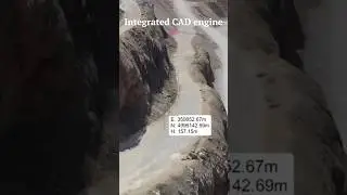
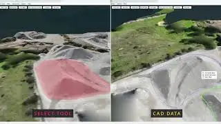
Use the CAD point generator and automatically extract 3D points from the point cloud. Simply define the grid shift between new points and create points as you would measure them on a field with your conventional equipment only 100 times faster!
There are other options available (you have the option to extract points):
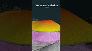
New points based on the calculation of the average height with a defined radius
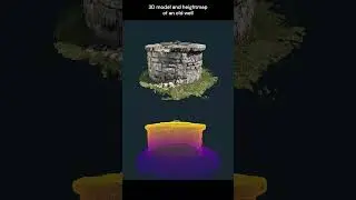
Snap-in option at the lowest point (ideal for areas with high vegetation to extract terrain points)
Advantages of the CAD point grid generator:
Create mapping maps even faster in 3dsurvey
Automatic extraction of terrain points in areas with high vegetation and creation of an accurate digital terrain model (where the classic classification cannot extract terrain points)
Create a sketch for your customers (PDF) or a report with information about the terrain height
3Dsurvey - By surveyors for surveyors
Hit the SUBSCRIBE button to keep updated ☑️
Ready to test out our FREE TRIAL? Sign up here: https://bit.ly/3D-free-trial
Follow us on social media:
Facebook: / 3dsurveysoftware
Instagram: / 3dsurvey
LinkedIn: / 4838939
Or visit our website: https://3dsurvey.si/