Data Analysis on River Height Data for Kayaking: An Extended Example
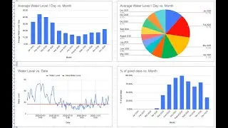
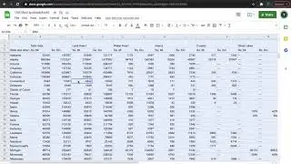
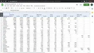
Using Google Sheets, I show you step by step how we can make some conclusions about a probable best time to go kayaking by examining historical water gauge levels. My example is specifically for kayaking to the Bottle Creek Indian Mounds in the Mobile-Tensaw delta, but this methodology could be used for other kayak trips where you have access to good data and a known water level limit. I hope you enjoy.
Template: https://docs.google.com/spreadsheets/...
Video produced by WILDERNESS PILGRIM LLC