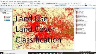
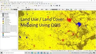
How to Create LULC using ArcGIS/ Supervised Classification and Calculate Area of LULC
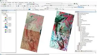
Classifying Landsat 8 image to make a land use land cover map.
Download Free Very High Aerial Imagery 0.5 meter, SRTM DEM,sentinel-2, Hyperion, LANDSAT-8 & Aster
• Download Free Very High Aerial Imager...
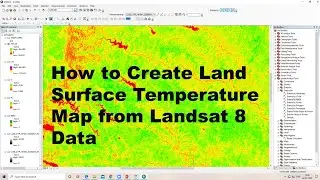
How to calculate land surface temperature from Landsat 8 Satellite Data
• How to calculate land surface tempera...
How to Create LULC using ArcGIS/ Supervised Classification
• How to Create LULC using ArcGIS/ Supe...
How to Create coronavirus Map in ArcGIS !! Health GIS
• How to Create coronavirus Map in ArcG...
Generate Contours and Slope From Google Earth in ArcGis
• Generate Contours and Slope From Goog...
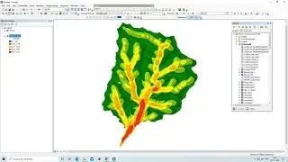
How to delineate watershed using DEM
• How to delineate watershed using DEM
Digitization in Arc GIS
• Digitization in Arc GIS
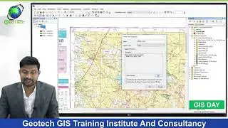
georeferencing and projection
• georeferencing and projection
Download Very High Resolution Google Earth Image//Georeferencing in ArcGIS
• Download Very High Resolution Google ...
Goodbye My Dear
• 'Goodbye My Dear' by @SteffenDaum 🇩🇪...
Relaxing Background Music For Videos, Meditations, Yoga, Spa - by AShamaluevMusic
• Relaxing - by AShamaluevMusic (Calm A...
Any Help Contact
Mr.Vikas [email protected]
WhatsApp Number= +918421031398
Email.Id:- [email protected]