Tutorial Download Citra Satelit Google Earth Resolusi Tinggi Ke ArcGIS | Mudah, Cepat, Akurat
Tutorial Download Citra Satelit Google Earth Resolusi Tinggi Ke ArcGIS | Mudah, Cepat, Akurat
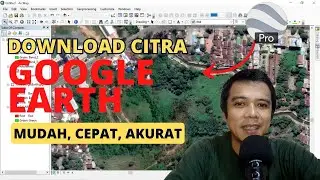
Dalam video tutorial ini, saya mencontohkan dan sekaligus menjelaskan tutorial download citra satelit Google Earth resolusi tinggi yang terbaru dan bagaimana membuka serta mengolahnya di ArcGIS.
Hasil pengolahan di ArcGIS akan menjadi citra satelit dalam format .tif yang sudah di georeferensi dan memiliki sistem koordinat. Jadi, citranya bisa digunakan untuk berbagai keperluan.
Silahkan ditonton video tutorial cara download citra satelit Google Earth nya sampai selesai dan saya percaya videonya pasti bermanfaat untuk teman-teman yang sedang membutuhkan.
**********************************
Butuh Jasa Pembuatan Peta & Pengolahan Data? atau Mau Kursus Private ArcGIS Online & Offline? Silahkan chat saya di https://wa.me/6282254782499 (WA Only & Bukan untuk melayani pertanyaan terkait tutorial)
**********************************
Tag :
peta, map, arcgis, tutorial, cara, arcmap, koordinat, pemula, cara mudah, shapefile, jpeg, google, earth, image, mapping, googling, mapper, learn, how to, how, to, download, high, quality, resolution, large, jpg, pdf, google map customizer, export, landscape, orthoimagery, ortho, photo,
areal photography, bing satelit, arcbrutile, basemap, imagery, georeferencing, mudah, image google earth, download google earth image, georefrence google earth image, get image from google earth, high satellite image from google earth, google earth, google earth pro