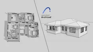
ArchiCAD Tutorial - Terrain Modelling (Step by Step)
Terrain modelling helps us to depict the building site in its physical form showing the exact landforms and slopes. In this #ARCHICAD video tutorial, I will show you how to model terrain based on a topographical survey.
Have you checked my website? It has an awesome collection of blog articles. Check it here: https://www.quantbuild.co.ke/blog/
ARCHICAD Basics Series Lessons for you: http://tiny.cc/kg80lz
Subscribe to this YouTube Channel: http://tiny.cc/ci80lz
Follow me on:
YouTube: http://tiny.cc/ci80lz
Facebook: / quantbuild
Instagram: / quantbuild_ke
Twitter: / quantbuild_ke
Website: https://www.quantbuild.co.ke/blog/


![Revit 2019 Beginner Tutorial - Color Fill Legend [Part 09]](https://images.videosashka.com/watch/A9zUTcYv64s)
![Revit 2019 Beginner Tutorial - Annotations (Tags and Dimensions) [Part 08]](https://images.videosashka.com/watch/zHvbzZ80YQM)
![Revit 2019 Beginner Tutorial - Floor, Ceiling and Roof [Part 07]](https://images.videosashka.com/watch/VmdTHSUWWfg)
![Revit 2019 Beginner Tutorial - Rooms and Room Tags [Part 06]](https://images.videosashka.com/watch/LZvWF0aA4gQ)
![Revit 2019 Beginner Tutorial - Interior Components [Part 05]](https://images.videosashka.com/watch/oPlNvLs1rMI)