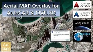
Insert Aerial Map into AutoCAD
OVERLAY AERIAL MAP FOR AUTOCAD & CIVIL 3D
In this video, I'm showing 3 sessions.
1. Update Online Map data (solve the issue "You do not have permission to access Online Map Data”)
Website: www.BIM-Infra.net
2. Overlay Aerial Map for Coordinated Drawing by using CIVIL3D.
3. Overlay Aerial Map for Non-Coordinated Drawing by using AutoCAD.
You can Watch the video about Setting Coordinate system from here: • Export AutoCAD C3D Drawing to Google ...
Please SUBSCRIBE this Channel: https://goo.gl/DCR3Ld
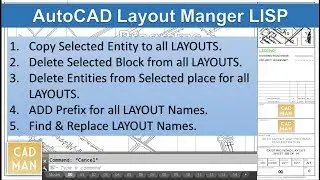
Automated AutoCAD Sheet Layout Creation Program: • AutoCAD Sheet Layouts by Automation
Regards,
Saifudheen Pottoor
Email: [email protected]
LinkedIn: / saifudheenp
Facebook: / 1933150026912923

![[FREE] Unodavid x Gee Yuhh Type Beat -](https://images.videosashka.com/watch/rTNXmz0OfBE)