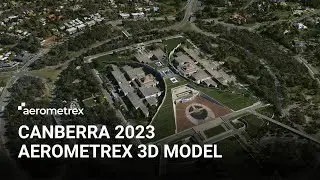
Canberra 3D Model - Nov 2020 [MetroMap 3D]
3D Model Specifications:
Resolution (GSD): 6 cm
Accuracy (RMSE): 25 cm
Area: 150 sq. km
Captured: November 2020
3D Model Formats & Outputs:
Cesium 3D Tiles / ESRI i3S-SLPK / 3MX / OBJ / True Ortho (additional formats and outputs available on request)
Aerometrex 3D - Capture & Processing:
This 3D model has been generated using advanced aerial acquisition and photogrammetry techniques that extract accurate geometric information from aerial photographs. Extremely dense 3D point clouds are generated prior to being transformed into a fully-textured mesh object. To generate geographically accurate data, precise ground control points are integrated into our processing chain. Special care and quality control systems are implemented at all stages of the process.
Major Applications:
Town planning, construction & engineering, transport and traffic management, asset management, tourism and investment, risk and emergency management, urban logistics
View and purchase this model here: https://metromap.com.au/plans/custom-...


![[TOP 100] MOST VIEWED KPOP SOLOIST MUSIC VIDEOS (December 2020)](https://images.videosashka.com/watch/8otjNSclbxQ)